Rochester weatherWhat’s on in Rochester →
Niagara Falls

Get out of town

Day trips from Rochester

15 nearby parks, towns and places to explore, ordered by straight-line distance.

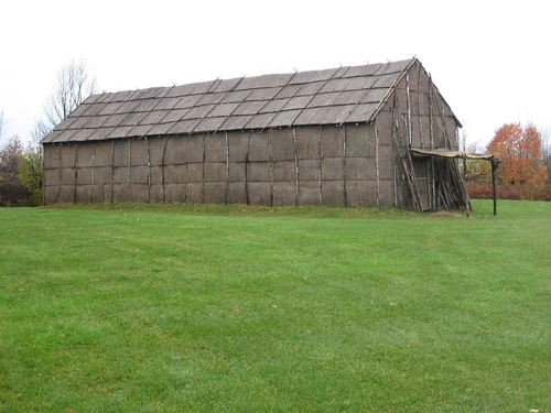
Ganondagan State Historic SiteState park

Ganondagan State Historic Site

17 miles southeast · straight-line distance

State historic site in New York, United States.

Confirm the visitor entrance, hours, reservations, access and seasonal conditions. Islands or water destinations may require different transport.
Hamlin Beach State ParkState park

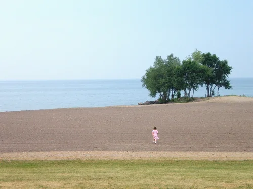
Hamlin Beach State Park

22 miles northwest · straight-line distance

Park in Hamlin, New York, USA.

Confirm the visitor entrance, hours, reservations, access and seasonal conditions. Islands or water destinations may require different transport.
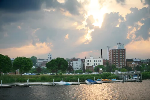
CanandaiguaTown

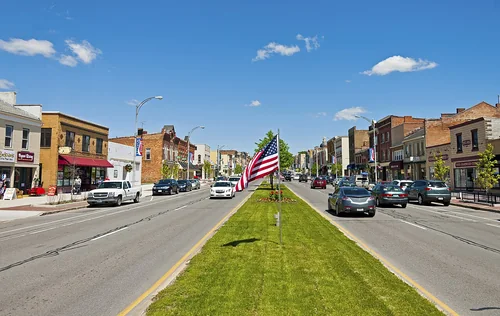
Canandaigua

25 miles southeast · straight-line distanceAbout 30 min by car (28 road miles, typical traffic, checked October 2026)

City in Ontario County, New York, United States.

Confirm the visitor entrance, hours, reservations, access and seasonal conditions. Islands or water destinations may require different transport.
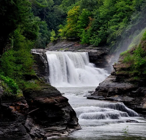
Town

Batavia

31 miles west · straight-line distanceAbout 35 min by car (34 road miles, typical traffic, checked October 2026)

City in New York, USA.

Confirm the visitor entrance, hours, reservations, access and seasonal conditions. Islands or water destinations may require different transport.
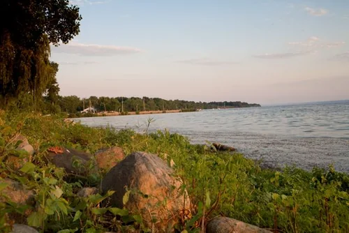
GenevaTown

Geneva

37 miles southeast · straight-line distanceAbout 45 min by car (45 road miles, typical traffic, checked October 2026)

City in New York, USA.

Confirm the visitor entrance, hours, reservations, access and seasonal conditions. Islands or water destinations may require different transport.
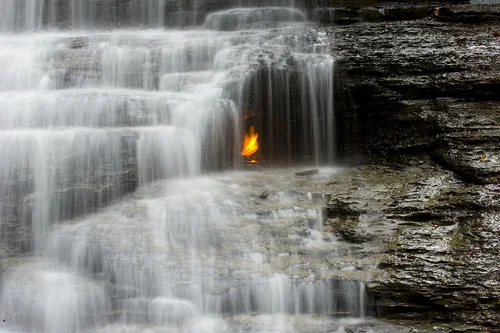
Letchworth State ParkState park

Letchworth State Park

41 miles southwest · straight-line distance

State park in New York, United States.

Confirm the visitor entrance, hours, reservations, access and seasonal conditions. Islands or water destinations may require different transport.
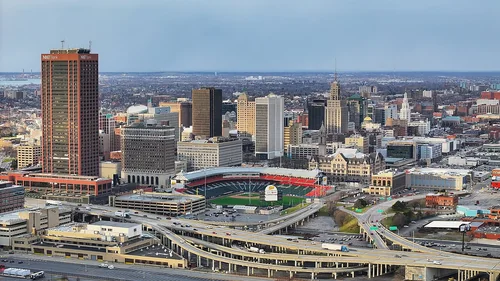
National park site

Women's Rights National Historical Park

44 miles east · straight-line distance

Historic park and museum in New York state, USA.

Confirm the visitor entrance, hours, reservations, access and seasonal conditions. Islands or water destinations may require different transport.
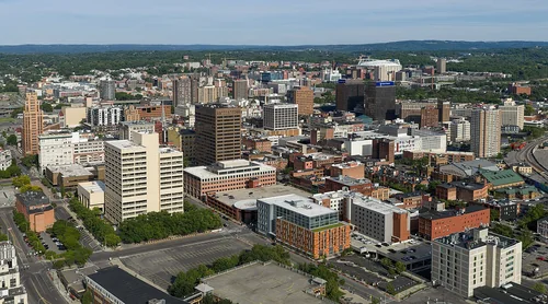
Seneca LakeLake

Seneca Lake

50 miles southeast · straight-line distance

Lake in New York, United States of America.

Confirm the visitor entrance, hours, reservations, access and seasonal conditions. Islands or water destinations may require different transport.
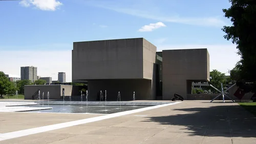
Eternal Flame FallsOutdoors

Eternal Flame Falls

66 miles southwest · straight-line distance

Waterfall in New York state, United States, known for flammable natural gas vent.

Confirm the visitor entrance, hours, reservations, access and seasonal conditions. Islands or water destinations may require different transport.
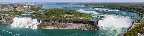
BuffaloTown

Buffalo

67 miles west · straight-line distanceAbout 1 hr 15 min by car (74 road miles, typical traffic, checked October 2026)

City and county seat of Erie County, New York, United States.

Confirm the visitor entrance, hours, reservations, access and seasonal conditions. Islands or water destinations may require different transport.
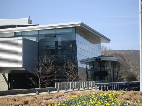
SyracuseTown

Syracuse

74 miles east · straight-line distanceAbout 1 hr 25 min by car (88 road miles, typical traffic, checked October 2026)

City in and county seat of Onondaga County, New York, United States.

Confirm the visitor entrance, hours, reservations, access and seasonal conditions. Islands or water destinations may require different transport.
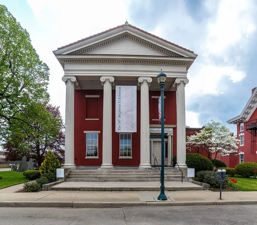
Everson Museum of ArtThings to do

Everson Museum of Art

74 miles east · straight-line distanceAbout 1 hr 25 min by car (88 road miles, typical traffic, checked October 2026)

Art museum in Syracuse, New York.

Confirm the visitor entrance, hours, reservations, access and seasonal conditions. Islands or water destinations may require different transport.

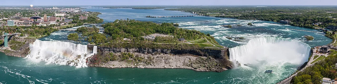
Niagara FallsOutdoors

Niagara Falls

74 miles west · straight-line distance

Three waterfalls that straddle the international border between Canada and the United States.

Confirm the visitor entrance, hours, reservations, access and seasonal conditions. Islands or water destinations may require different transport.

Corning Museum of GlassThings to do

Corning Museum of Glass

75 miles south · straight-line distanceAbout 1 hr 40 min by car (101 road miles, typical traffic, checked October 2026)

Museum in Corning, New York.

Confirm the visitor entrance, hours, reservations, access and seasonal conditions. Islands or water destinations may require different transport.

Arnot Art MuseumThings to do

Arnot Art Museum

84 miles southeast · straight-line distanceAbout 1 hr 55 min by car (120 road miles, typical traffic, checked October 2026)

Art museum in Elmira, New York.

Confirm the visitor entrance, hours, reservations, access and seasonal conditions. Islands or water destinations may require different transport.

Driving times are typical estimates from the city center without live traffic, Powered by Geoapify · © OpenStreetMap contributors.

Distances are straight-line measurements from the city, not driving distance. Saved road estimates have no consistently recorded source date and are not current traffic; estimates to park centers, water locations or inconsistent routes are omitted. Named-destination route links are not verified entrances. Place descriptions come from Wikidata; photo credits below include recorded capture dates when available. A photograph does not show current conditions.

Outdoor places near Rochester

34 recreation areas and campgrounds within 134 miles, from Recreation.gov. Filter by what you want to do.

Recreation area

Mount Morris Dam and Recreation Area

35 miles southwest · straight-line distanceUS Army Corps of Engineers

The US Army Corps of Engineers built the Mount Morris Dam in the late 1940s to reduce flooding on the lower Genesee River.

BoatingHikingPicnickingWater sportsWinter sports

Recreation area

Iroquois National Wildlife Refuge

40 miles west · straight-line distanceFish and Wildlife Service

Our namesake comes from the Iroquois (Haudenosaunee) Confederacy, a powerful and enduring alliance that has thrived in the northeast for centuries.

BikingBirdingBoatingCross Country SkiingFishingHikingHuntingIce Fishing

Recreation area

Montezuma National Wildlife Refuge

46 miles east · straight-line distanceFish and Wildlife Service

Establishing the Montezuma National Wildlife Refuge in 1938 was the first step of many to restore the area back to its historic expanse of marshes—an area thriving with wildlife, once used by indigenous people for hunting and fishing.

BirdingBoatingCross Country SkiingEducational ProgramsFishingHikingHuntingMotor Boat

Recreation area

Harriet Tubman National Historical Park

55 miles east · straight-line distanceNational Park Service

Harriet Tubman was guided by a deep faith and devotion to family, freedom, and community. After emancipating herself and members of her family, she moved them from Ontario, Canada to Fleming and Auburn, New York in 1859.

Picnicking

Recreation area

Almond Lake

56 miles south · straight-line distanceUS Army Corps of Engineers

Kanakadea Park operated by Stuben County, NY is located on Almond Lake. Camping and day use facilities for picnicing and boating are available.

BoatingCampingHikingHotel/Lodge/Resort Privately OwnedPicnickingWater sportsWildlife viewing

Recreation area

Green Mountain & Finger Lakes National Forests

61 miles southeast · straight-line distanceUSDA Forest Service

BikingFishingHikingHorseback ridingPicnickingSwimmingWildlife viewingWinter sports

Campground

Backbone Horse Campground

62 miles southeast · straight-line distanceAbout 1 hr 35 min by car (81 road miles, checked October 2026)USDA Forest Service

Backbone Horse Campground is a small, semi-primitive campground designed primarily for campers or picnickers that bring horses with them.

Camping

Campground

Blueberry Patch Campground

62 miles southeast · straight-line distanceAbout 1 hr 35 min by car (82 road miles, checked October 2026)USDA Forest Service

Blueberry Patch Campground is a small, semi-primitive campground located along Picnic Area Road (County Route 2), next to the large blueberry patch it received its name from.

Camping

Campground

Potomac Group Campground

62 miles southeast · straight-line distanceAbout 1 hr 40 min by car (83 road miles, checked October 2026)USDA Forest Service

Potomac Group Campground and Day Use Area provides a primitive camping experience for groups of 8-40 people. It is an excellent site for family events and youth group activities.

CampingFishingHikingHuntingSwimmingWildlife viewingWinter sports

Recreation area

Cowanesque Lake

84 miles south · straight-line distanceUS Army Corps of Engineers

This Corps project located near the New York state line in North Central Pennsylvania provides a 1,085-acre lake with 17 miles of shoreline for use by campers and day trippers.

BoatingCampingFishingHikingNature educationPicnickingWater sportsWildlife viewing

Campground

South Shore Recreation Area

84 miles south · straight-line distanceAbout 1 hr 55 min by car (119 road miles, checked October 2026)US Army Corps of Engineers

South Shore Recreation Area is located on the south side of the Cowanesque Lake along State Route 49, just five miles west of Lawrenceville, Pennsylvania.

BoatingCampingFishingHiking

Campground

Tompkins

84 miles south · straight-line distanceAbout 1 hr 55 min by car (118 road miles, checked October 2026)US Army Corps of Engineers

Tompkins Campground is on the north shore of Cowanesque Lake in the northern tier of Pennsylvania, less than one mile from the New York state border.

BoatingCampingFishingHiking

Campground

Lawrence Recreation Area

85 miles south · straight-line distanceAbout 1 hr 55 min by car (117 road miles, checked October 2026)US Army Corps of Engineers

Lawrence Recreation Area is a day-use facility on the south side of Cowanesque Lake. It is conveniently located on State Route 49 approximately 4 miles west of Lawrenceville, Pennsylvania.

CampingFishingHiking

Campground

Ives Run

90 miles south · straight-line distanceAbout 2 hr 5 min by car (127 road miles, checked October 2026)US Army Corps of Engineers

Ives Run Campground sits on the eastern shore of Hammond Lake in north-central Pennsylvania.

BoatingCampingDisc GolfFishingHikingHuntingSwimming

Recreation area

Tioga-Hammond Lakes

90 miles south · straight-line distanceUS Army Corps of Engineers

Twin lakes in north central Pennsylvania with overnight and dayuse facilities in a scenic environment, southwest of Tioga, PA and north of Wellsboro on PA Route 287, which is acessable from U.S. Route 15 northeast of Tioga and U.S.

BoatingCampingFishingHikingNature educationPicnickingWater sportsWildlife viewing

Recreation area

Whitney Point

93 miles southeast · straight-line distanceUS Army Corps of Engineers

Broome County operates Dorchester Park on Whitney Point Lake. Day use facilities include a beach, boat launch, picnic area, pavilions and open play areas.

BikingBoatingHikingPicnickingWater sportsWildlife viewingWinter sports

Campground

Lambs Creek Recreation Area

96 miles south · straight-line distanceAbout 2 hr by car (128 road miles, checked October 2026)US Army Corps of Engineers

Lambs Creek Recreation Area is located at the southern end of Tioga Lake, just north of the borough of Mansfield, PA. The recreation area is easily accessible from US Route 15 and offers a great location for picnicking, hiking and biking.

BikingCampingHikingHunting

Campground

Willow Bay

104 miles southwest · straight-line distanceAbout 2 hr 40 min by car (133 road miles, checked October 2026)USDA Forest Service

Willow Bay is located within the Allegheny National Recreation Area, about 16 miles from Bradford, in northwestern Pennsylvania.

BoatingCampingFishingHikingRanger programsSwimmingWater sportsWildlife viewing

Campground

Tracy Ridge

106 miles southwest · straight-line distanceAbout 2 hr 50 min by car (138 road miles, checked October 2026)USDA Forest Service

Tracy Ridge Campground is located within the Allegheny National Recreation Area, approximately 15 miles from Bradford, Pennsylvania. Allegheny Reservoir is just minutes away.

BoatingCampingFishingHikingWater sports

Recreation area

Fort Stanwix National Monument

109 miles east · straight-line distanceNational Park Service

For centuries, the Oneida Carrying Place, a six-mile portage connecting the Mohawk River and Wood Creek, served as a vital link for those traveling by water from the ocean to the Great Lakes.

BikingHikingHistoryPicnicking

Campground

Dewdrop

115 miles southwest · straight-line distanceAbout 3 hr by car (161 road miles, checked October 2026)USDA Forest Service

Dewdrop Campground sits on the Kinzua Arm of the Allegheny Reservoir in northwest Pennsylvania, offering a popular getaway for boaters and families. Recreation Water activities abound, including lake fishing, boating, and water skiing.

BoatingCampingFishingMountain BikingSwimmingWater sports

Campground

Kiasutha

115 miles southwest · straight-line distanceAbout 3 hr by car (162 road miles, checked October 2026)USDA Forest Service

Kiasutha Campground sits on the Kinzua Arm of the Allegheny Reservoir in northwest Pennsylvania, offering countless water activities. Recreation Visitors enjoy the large, grassy beach for swimming and relaxing.

CampingFishingHikingSwimming

Campground

Red Bridge (Pa)

115 miles southwest · straight-line distanceAbout 2 hr 55 min by car (159 road miles, checked October 2026)USDA Forest Service

Red Bridge Campground sits on the eastern shore of the Kinzua Arm of the Allegheny Reservoir in northwest Pennsylvania, offering a peaceful getaway for families and outdoor enthusiasts.

BoatingCampingFishingHiking

Recreation area

Allegheny Reservoir

116 miles southwest · straight-line distanceUS Army Corps of Engineers

Totally surrounded by forest, Kinzua Dam and Allegheny Reservoir are the heart of one of the largest and most popular outdoor recreation complexes in the northeastern United States.

BoatingCampingFishingHikingNature educationPicnickingWater sportsWildlife viewing

Campground

East Branch Campground

121 miles southwest · straight-line distanceAbout 3 hr 5 min by car (171 road miles, checked October 2026)US Army Corps of Engineers

East Branch Campground is located at East Branch Lake in Northeastern Elk County. East Branch Lake offers an excellent freshwater fishery as well as other recreational opportunities from hiking, boating, and picnicking.

BoatingCampingCanoeingFishingHikingKayakingWater ActivitiesWildlife viewing

Recreation area

East Branch Clarion River Lake

121 miles southwest · straight-line distanceUS Army Corps of Engineers

Elk State Park is located at this lake in scenic western Pennslyvania, 14 miles north east of Johnsonburg.

BoatingCampingHikingNature educationPicnickingWater sportsWildlife viewing

Campground

Twin Lakes (Pa)

122 miles southwest · straight-line distanceAbout 3 hr 5 min by car (170 road miles, checked October 2026)USDA Forest Service

Rec.gov campsite availability grid is not reflective of availability. For more information on reservations, please visit http://fotlanf.org/ Twin Lakes Campground is located near a small, spring-fed, trout-stocked lake, popular with…

CampingFishingHikingSwimming

Campground

Buckaloons

124 miles southwest · straight-line distanceAbout 2 hr 55 min by car (168 road miles, checked October 2026)USDA Forest Service

Buckaloons Campground sits at the confluence of the Allegheny River, Brokenstraw Creek and Irvine Run in northwestern Pennsylvania.

BoatingCampingCanoeingFishingKayaking

Recreation area

Kettle Creek Lake

125 miles south · straight-line distanceUS Army Corps of Engineers

Surrounded by high mountains in a wild and scenic area, Kettle Creek State Park provides day use recreation facilities on Alvin R. Bush reservoir and campground adjacent to Corps land on the lake and downstream of the dam.

BoatingHorseback ridingPicnickingWater sportsWildlife viewingWinter sports

Campground

Farnsworth Cabin

128 miles southwest · straight-line distanceAbout 3 hr 15 min by car (175 road miles, checked October 2026)USDA Forest Service

Farnsworth Cabin is tucked away in the northwest portion of Pennsylvania's Allegheny National Forest. Built in the 1930s by the Civilian Conservation Corps, the stone cabin is conveniently located 8.5 miles northwest of Sheffield.

BikingCampingFishingHikingHuntingWildlife viewingWinter sports

Campground

Hearts Content Recreation Area

131 miles southwest · straight-line distanceAbout 3 hr 15 min by car (176 road miles, checked October 2026)USDA Forest Service

Hearts Content Campground is a semi-primitive family campground bordering the Hickory Creek Wilderness Area and surrounded by native hardwoods and a patch of planted pine forest.

CampingHikingWinter sports

Recreation area

East Sidney Lake

134 miles southeast · straight-line distanceUS Army Corps of Engineers

The recreation area is lease to the Town of Sidney, NY. Facilities include camping, picnic area, boat launch and beach.

BoatingCampingFishingPicnickingWater sportsWildlife viewing

Recreation areas and campgrounds from Recreation.gov's directory, checked October 9, 2026. Listings are not live availability: check Recreation.gov or the managing agency for open dates, fees, reservations and conditions. Directions go to the listed coordinates, which may not be the entrance. Campground driving times: Powered by Geoapify · © OpenStreetMap contributors.

Questions

What day-trip ideas are near Rochester?

This guide includes Ganondagan State Historic Site, Hamlin Beach State Park, Canandaigua, Batavia, Geneva. Places are ordered by straight-line distance. Confirm visitor access, opening hours and current travel conditions before choosing a trip.

How far is Ganondagan State Historic Site from Rochester?

Approximately 17 miles southeast in a straight line. This is not current traffic or a route to a verified visitor entrance. Use the named destination and confirm the appropriate entrance or transport.

How far is Hamlin Beach State Park from Rochester?

Approximately 22 miles northwest in a straight line. This is not current traffic or a route to a verified visitor entrance. Use the named destination and confirm the appropriate entrance or transport.

How far is Canandaigua from Rochester?

Approximately 25 miles southeast in a straight line; driving takes about 30 min over 28 road miles in typical traffic (Geoapify, checked October 2026). This is not current traffic or a route to a verified visitor entrance. Use the named destination and confirm the appropriate entrance or transport.

Where can I camp near Rochester?

Recreation.gov lists 18 campgrounds within 131 miles, including Backbone Horse Campground (62 miles southeast), Blueberry Patch Campground (62 miles southeast), Potomac Group Campground (62 miles southeast). Check Recreation.gov for current availability, seasons and reservations.

Rochester AI

Your Rochester local guide
Hey there!

I'm Rochester AI. Ask about local food, shopping, history or a day out.

AI recommendations may be inaccurate. Verify hours and prices. Questions are processed by Cloudflare. Privacy